Arunachal Pradesh
From Wikipedia, the free encyclopedia
| Arunachal Pradesh | |||
|---|---|---|---|
| — State — | |||
| |||
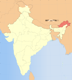
| Location of Arunachal Pradesh in India | |||
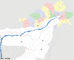
| Map of Arunachal Pradesh | |||
| Coordinates (Itanagar): 27.06°N 93.37°ECoordinates: 27.06°N 93.37°E | |||
| Country | |||
| Established | 20 February 1987 | ||
| Capital | Itanagar | ||
| Largest city | Itanagar | ||
| Districts | 16 | ||
| Government | |||
| - Governor | Joginder Jaswant Singh (2008-) | ||
| - Chief Minister | Jarbom Gamlin (2011-) | ||
| - Legislature | Unicameral (60 seats) | ||
| Area | |||
| - Total | 83,743 km2 (32,333.4 sq mi) | ||
| Area rank | 14th | ||
| Population (2011) | |||
| - Total | 1,382,611 | ||
| - Rank | 26th | ||
| - Density | 16.5/km2 (42.8/sq mi) | ||
| Time zone | IST (UTC+05:30) | ||
| ISO 3166 code | IN-AR | ||
| HDI | |||
| HDI rank | 18th (2005) | ||
| Literacy | 66.95% | ||
| Official languages | English[1][2][3] | ||
| Website | arunachalpradesh.nic.in | ||
Arunachal Pradesh means "land of the dawn lit mountains"[4] in Sanskrit. It is also known as "land of the rising sun"[5] ("pradesh" means "state" or "region") in reference to its position as the easternmost state of India. Most of the people native to and/or living in Arunachal Pradesh are of Tibeto-Burmanorigin. A large and increasing number of migrants have reached Arunachal Pradesh from many other parts of India, although no reliable population count of the migrant population has been conducted, and percentage estimates of total population accordingly vary widely. Part of the famous Ledo Burma Road, which was a lifeline to China during World War II, passes through the eastern part of the state.


No comments:
Post a Comment